YellowScan Navigator: Bathymetric LiDAR for Shallow-Water Mapping
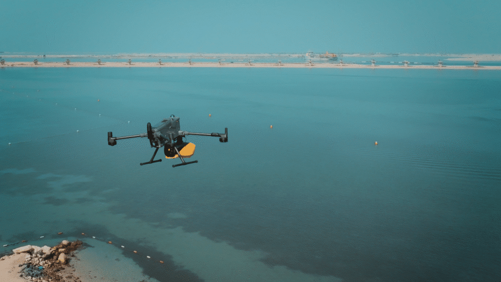
Bathymetric LiDAR For Shallow-Water Mapping Accurate mapping in aquatic environments has always presented a unique challenge. Traditional methods, such as sonar or boat-based surveying, can be slow, expensive, and limited by accessibility – especially in shallow or transitional zones where water meets land. This is where bathymetric LiDAR technology has become essential, offering an airborne solution that can efficiently capture both shallow water and terrestrial topography in a single dataset. Among the current generation of bathymetric LiDAR systems, the YellowScan Navigator stands out for its focus on shallow-water environments, compact design, and compatibility with a range of UAV platforms – including the DJI M400, one of the most versatile professional drones on the market. What Is Bathymetric LiDAR? Bathymetric LiDAR uses a green laser that penetrates the water surface, allowing measurements of both the water column and the seabed. By combining this data with conventional LiDAR returns from land, users can create continuous, high-resolution 3D models of the coastal interface. While some bathymetric systems are designed for deep-water applications, the YellowScan Navigator is optimised specifically for shallow-water and nearshore mapping. This distinction is crucial: rather than attempting to penetrate deep depths, the Navigator prioritises data accuracy and point density in shallower, more dynamic zones where detailed understanding of the environment is required. Why Shallow Water Mapping Matters Shallow-water environments are some of the most complex and valuable ecological and engineering zones on Earth. They’re dynamic, ever-changing, and often difficult to reach. For surveyors, environmental consultants, and construction teams, gaining accurate bathymetric and topographic data in these areas is essential for planning, monitoring, and management. The YellowScan Navigator delivers reliable results in such conditions – especially in locations like: • Mangrove ecosystems, where conventional surveying is hindered by dense vegetation and tidal variability. • Coastal erosion and sediment transport studies, where frequent and accurate elevation data supports long-term environmental monitoring. • Island construction and land reclamation projects, where engineers require precise pre- and post-dredging models. In all these applications, the ability to collect both land and shallow-water data in one flight significantly improves efficiency while reducing field time and risk. A Compact, Efficient, and Precise Solution Weighing 4.5kg including the battery, the YellowScan Navigator achieves a balance between performance and portability that’s well-suited to UAV operations. The system is built around YellowScan’s established focus on reliability and user simplicity, offering a streamlined workflow from acquisition to processing.The Navigator is lightweight, which means it can be deployed on several UAV platforms without compromising stability or endurance. The DJI Matrice 400 RTK (M400) is a particularly strong pairing – combining robust flight control, advanced RTK positioning, and an open payload architecture that accommodates professional sensors like the Navigator with ease. The system is also compatible with other industrial-grade platforms such as the Hexadrone Tundra 2, Beyond Vision BVQ418, and Acecore Noa, giving operators flexibility depending on their operational requirements or existing fleet. Balanced Perspective: Choosing the Right Tool While the YellowScan Navigator offers a strong balance of accuracy, weight, and UAV compatibility, it’s not a one-size-fits-all solution. Bathymetric LiDAR selection depends on project depth requirements, water clarity, and the operational environment. For example, projects demanding deeper water penetration may benefit from alternative systems or complementary sonar-based solutions. However, for shallow-water mapping, coastal engineering, or environmental monitoring, the Navigator remains one of the most efficient and cost-effective options on the market. Its streamlined integration and dependable performance make it a practical choice for operators who need consistent, high-quality data across complex coastal or inland water environments. YellowScan Navigator Demo Day – JA Resort, Dubai On Friday 3rd October, we hosted a YellowScan Navigator demo day at JA Resort, Dubai, giving attendees the chance to see the system in action. The event featured a live flight over shallow coastal waters, showcasing the YellowScan LiDAR payload in a real-world environment. After the flight, participants reviewed and processed the collected data together, demonstrating how efficiently the system captures accurate bathymetric and topographic information in shallow-water conditions. The demo highlighted the Navigator’s ease of deployment, precision, and practical applications – from environmental monitoring to coastal engineering projects. It provided attendees with a clear, hands-on understanding of how bathymetric LiDAR can improve efficiency, reduce field time, and deliver high-quality data for complex survey operations. Available Through Drone Shop As an authorised YellowScan dealer, DroneShop.ae supports survey professionals, engineering firms, and environmental specialists in selecting and integrating the right payloads for their operational goals. We supply and support a range of YellowScan LiDAR solutions – including the YellowScan Navigator – and work with clients to identify the most appropriate combination of drone, payload, and workflow for their project requirements. For advice on choosing a LiDAR system or integrating the Navigator with your drone, contact our team for technical guidance and availability. Related Blogs
Hobbyist Drone Flying Returns to Dubai: What You Need to Know
Click Here To Read The Latest Hobbyist Update August 2025 Introduction to Drone Regulations in the UAE The UAE stands out as a global leader in the adoption and regulation of drone technology, offering a comprehensive legal framework that ensures the safe operation of drones within its airspace. As drones become more and more popular in commercial activities and recreational interests, understanding the local regulations is crucial for anyone operating in this space. In this article we will outline the key aspects of drone regulations in the UAE, helping pilots and businesses to ensure they are compliant and don’t fall foul of the law. New Changes for 2025 Latest GCAA Rule Update From January 2025, new drone regulations will apply across the UAE. You will no longer be allowed to fly in GCAA-regulated areas unless you have completed certified drone training through an officially GCAA-approved academy. This applies to all drone operators, including those flying for recreational or commercial purposes. At Drone Shop, we are on hand to help you start your drone pilot training, obtain your drone training certificate, and access beginner-friendly drone flying courses through GCAA-certified trainers. Before you can begin any training, you will need to get a security clearance certificate – this is a legal requirement and usually takes around 3 to 4 weeks to complete. We can guide you through this step as part of the training process. To stay informed as regulations change, we strongly recommend downloading and regularly checking the Drones UAE app, which provides real-time updates on approved flying zones and the latest drone rules across the UAE. While we do our best to offer accurate guidance, Drone Shop cannot be held responsible for any outdated or incorrect information – always refer to the official Drones UAE app before flying. DCAA has implemented two new changes to the flight permit application process: Anyone looking to obtain permits to fly drones must have a Dubai trade license to be able to apply. For NOTAMS, DANS have taken over the process of doing this for flights with exceptional circumstances like higher flight height or restricted flight zones. The normal DCAA process is still in place, but you now need DANS NOC to be able to fly drones in exceptional circumstances. Registration and Licensing In the UAE, the registration of drones is mandatory for both recreational and commercial users, whether you are looking to carry out drone inspections, surveying and mapping or aerial photography. This process is managed by the General Civil Aviation Authority (GCAA), which requires all UAVs to be registered with them and pilots to obtain the appropriate licenses before operating the drones. For commercial operations, additional permits are usually required, first from the MOD (Ministry of Defence) as well as clearance from the local authority depending on which Emirate you are in (a list of these below.) The permit process typically involves providing detailed operation plans and undergoing safety assessments. The process of obtaining the permits generally takes around 14 working days. Local Civil Aviation Authorities in the UAE: DCAA (Dubai Civil Aviation Authority) ADCA (Abu Dhabi Civil Aviation Authority) DCA (Department of Civil Aviation Sharjah) FIA (Fujairah International Airport) RAK Airport (Ras Al Khaimah) Great news for drone enthusiasts – hobbyist flying is finally back in Dubai. With the city’s incredible skyline, wide-open deserts, and one-of-a-kind landmarks, it’s no wonder so many people are keen to get their drones in the air again. Of course, before you take off, there are a few important rules and approvals to keep in mind. We’ve pulled together the essentials to help you enjoy your flights safely, confidently, and legally. Why the Rules Matter Flying a drone isn’t just about having fun – it’s about being part of a carefully managed airspace. Dubai’s skies are shared with commercial aircraft, helicopters, and other essential operations, so authorities need to make sure drones don’t interfere with flights or critical infrastructure. That’s why the GCAA and DCAA have put clear frameworks in place: they help prevent accidents, protect public spaces, and keep the city running smoothly. Ignoring the rules can have serious consequences, from hefty fines to confiscation of your drone. But following them doesn’t just keep you out of trouble – it also helps ensure that recreational drone flying remains possible for everyone. By respecting the regulations, you’re contributing to a safe, organized, and enjoyable flying environment, making it easier for hobbyists to capture Dubai from above without disruptions or incidents. Getting Your Licence Before you take to the skies, it’s important to know exactly what approvals and training you need. Requirements differ depending on whether you’re flying as a hobbyist or commercially, and whether you’re in Dubai or elsewhere in the UAE. In the UAE, the GCAA and DCAA have distinct roles: The GCAA handles federal licensing, drone registration across the Emirates, operator authorisations, and security checks – especially for commercial flights – ensuring pilots meet national safety standards. The DCAA manages approvals specific to Dubai. Hobbyist pilots need DCAA-approved training and registration, while commercial operators require project permits, insurance, and security clearances. Together, these authorities ensure that all flights in Dubai are safe, coordinated, and fully compliant. Hobbyist Flying If you’re flying drones for personal enjoyment, like photography or practising your skills, the requirements depend on where you are. In Dubai, hobbyist pilots only need approval from the DCAA. In the rest of the UAE, hobbyists register with the GCAA. In both cases, completing an app roved training course is essential to ensure you understand the rules, fly safely, and stay within legal limits. Commercial Flying For professional operations – such as mapping, surveying, inspections, or aerial filming – both DCAA and GCAA approvals are required when flying in the Emirates. Commercial pilots must complete the relevant training and certification, obtain the necessary permits, and meet all operational requirements, including safety checks and insurance. At Drone Shop, our training courses take care of all the steps for you. From registration and certification to guidance on
Upgrading Your DJI Matrice 350? Here’s why the new 400 Could Be the Right Move

As DJI continues to push the boundaries of commercial drone technology, the launch of the Matrice 400 has sparked interest across the industry. Building on the proven capabilities of the Matrice 350, the new M400 brings a range of updates – but is it truly a worthwhile upgrade? In this blog, we take a closer look at both models, comparing performance, payload capacity, flight systems, and use-case benefits to help you decide whether sticking with the 350 is enough, or if the 400 offers the leap forward your operations need. Payload Interfaces and Capacity: What’s New in the M400 When it comes to carrying power, the new DJI Matrice 400 takes a clear step forward. While the Matrice 350 RTK can handle up to 2.7 kg and supports up to three mounted payloads at once, the M400 more than doubles that capacity – supporting up to 6 kg and allowing for as many as seven different payloads to be mounted. The M400 is also equipped with four external E-Port V2 interfaces, giving users more flexibility when it comes to connecting equipment. Even better, one of these ports (E4) is expandable and can be split into four additional connections, significantly boosting the drone’s multi-payload capability for more complex missions. One of these ports, the E4, can be expanded into four extra connections – greatly increasing the drone’s capacity to handle multiple payloads for more advanced operations. Built for Bigger Missions One of the most practical upgrades in the DJI Matrice 400 is its significantly improved flight time. While the Matrice 350 RTK delivers up to 42 minutes of airtime, the M400 stretches that to 59 minutes when paired with a standard H30T, L2, or P1 payload. That’s nearly 50% more time in the air – a serious advantage for long or complex missions. But it’s not just about staying in the air longer. The M400 is also faster and more efficient across the board. It reaches a topflight and route speed of 25 m/s – around 60% faster than the M350 RTK. It also climbs and descends more quickly, with ascent speeds of up to 10 m/s and descent speeds of 8 m/s. Battery performance also sees a meaningful upgrade. The M400 uses the new TB100 high-density battery, which not only delivers more power but also charges faster – just 45 minutes compared to 60 minutes for the M350 RTK’s TB65 battery. Additionally, the M400 supports tethered power options, making it even better suited for extended or stationary operations – something that DJI doesn’t offer. Whether you’re surveying large areas, capturing detailed data across multiple points, or responding to critical situations where every minute matters, the extended flight time, battery life and increased speed help reduce downtime whilst keeping operations moving smoothly. Designed for Safer Operations The Matrice 400 takes safety to the next level with a powerful sensor system combining rotating LiDAR, six-direction mmWave radar, and four full-colour low-light fisheye vision sensors. Unlike the Matrice 350, which does not include rotating LiDAR and only offers mmWave radar as an optional add-on, the M400’s integrated mmWave radar provides strong penetration in rain, fog, and snow, capturing both range and velocity information in real-time. Meanwhile, the M400’s vision sensors capture rich visual details like colour, shape, and texture, enabling full-colour flight assist displays. Combined, these advanced technologies provide unparalleled obstacle detection – capable of identifying even the smallest details like power lines, regardless of lighting, terrain, or harsh weather – marking a significant leap forward in operational safety and reliability. https://droneshop.ae/wp-content/uploads/2025/07/STOCK-VID-CLIP.mp4 Upgraded Video Feed You Can Count On The Matrice 400 features the new DJI O4 Enterprise transmission system, doubling the range of the Matrice 350 – from 20 km to up to 40 km (under FCC conditions). It also adds dual 4G dongle support for network redundancy and airborne relay for better performance in obstructed areas. Unlike the 350, the M400 also supports a sub-2G band for more stable transmission in high-interference or long-range environments, though it is recommended that operators ensure compatibility with local frequency regulations prior to deployment. Advanced Detection and Automation Capabilities When paired with the Zenmuse H30 series, the Matrice 400 brings enhanced detection capabilities through both visible light and thermal imaging. It can smartly identify targets like vehicles and vessels, seamlessly switch between detection modes, and even automatically count objects within its field of view. The Matrice 350 RTK supports visible light detection for smart tracking of vehicles and boats, while the Matrice 400 adds full thermal imaging support for greater versatility. The M400 also supports integration with third-party detection models and includes object counting and statistical features – tools that aren’t available on the M350 RTK. Beyond detection, the Matrice 400 improves mission execution with real-time obstacle avoidance during L2-guided routes and tailored flight path planning for slopes, geometric shapes, and building facades. Managed via DJI Pilot 2 or FlightHub 2, these features simplify complex workflows and reduce the need for constant manual control. In comparison, the Matrice 350 RTK offers more basic flight path management. Both drones are capable, but the M400 has additional tools on board, designed for more demanding missions. The Matrice 400’s Smart Flight Mode Upgrades The Matrice 400 offers significant upgrades over the 350, introducing six intelligent flight modes designed to simplify complex tasks, improve safety, and enhance mission efficiency: – Real-time Terrain Follow: Maintains consistent altitude relative to uneven ground, ideal for mountainous terrain and precise mapping. – Ship-Based Take-off and Landing: Enables smooth operations from stationary or slow-moving vessels, expanding offshore mission capabilities. – Cruise Mode: Allows continuous flight at a set speed and direction, perfect for long-distance inspections like pipelines or roads. – FlyTo Target Point: Automatically calculates the safest, most efficient path to a target, adapting to obstacles and terrain in real time. – POI Orbiting: Circles a designated target while keeping the camera focused, great for structural surveys and video capture. – Observed View: Displays previously covered areas on the controller map, helping avoid
Why The Flyability Elios 3 Is A Smart Choice For Your Business

Inspections are often required in spaces that are difficult to navigate. Whether it’s limited space, unstable ground, or a safety concern, reaching certain areas on-site can quickly become a challenge – and a costly, time consuming one at that.This is where the Flyability Elios 3 stands out. It’s built to support teams working in complex environments, helping them carry out inspections without needing to send people into potentially risky or restricted areas. When time, safety, and access are all critical factors, having a reliable tool that can get eyes on hard-to-reach places can make a real difference to how a task is completed. A More Efficient Way Of Working Thanks to its collision-tolerant cage, the Elios 3 can fly close to assets and structures without the risk of damage, even in tight, cluttered spaces, and with its unique ability to operate in GPS-denied environments – including underground, inside tanks, or within complex facilities – this drone removes many of the constraints associated with traditional inspections. Flight times of up to 12 minutes, combined with hot-swappable batteries and fast set up and deployment, mean teams can complete thorough inspections in less time. The drone’s powerful onboard lighting and 4K camera provide high-resolution visuals, reducing the need for repeated flights and costly second guesses. For businesses, this means fewer shutdowns, faster decision-making, and better use of resources – all of which add up to a smarter, more cost-effective way of working. Technology That Supports Your Team The Elios 3 is designed to make complex inspection work more manageable – giving teams the tools they need to navigate confined, high-risk environments with greater control and confidence. At its core is FlyAware™, Flyability’s real-time navigation system that combines LiDAR and computer vision to generate a live 3D map during flight. This gives operators a clear view of their surroundings and progress, helping them stay oriented and ensure full inspection coverage. Data is displayed clearly in the Cockpit app throughout the flight, and once the job is done, teams can review footage, extract images, and create reports using Inspector 4.0 – keeping the entire process efficient, from planning to post-inspection. Payload Options That Adapt to Your Needs The Elios 3 features a modular payload bay with two dedicated ports – one for LiDAR and one for auxiliary payloads – giving teams the flexibility to adapt the drone to different missions and environments. For detailed spatial data, the Surveying Payload delivers high-precision LiDAR, ideal for 3D modelling, structural mapping, and inspections in inaccessible areas. It supports a range of industries where accurate visuals and measurement are essential. For more specialised use cases, the RAD Payload enables remote radiation detection and localisation, allowing teams to assess hazardous environments without direct exposure -particularly valuable in nuclear facilities and decommissioning projects. The Flyability Elios 3 UT is the latest payload that turns the Elios 3 drone into a flying ultrasonic thickness gauge. It provides accurate thickness measurements with high-resolution scans in even the toughest environments. Easily mounted on the top, front, or bottom of the drone, this adaptable tool allows industry professionals to perform quick, reliable integrity inspections. Interested To Find Out More? The Elios 3 isn’t just a high-tech drone – it’s a practical tool built to handle the real-world challenges of industrial inspection. From navigating confined spaces to delivering accurate, actionable data, it supports teams in working more safely, efficiently, and with greater confidence. With its modular design, intelligent navigation, and expanding range of payloads, it’s a system that adapts to your needs – not the other way around. Whether you’re taking your first steps into drone-based inspection or looking to upgrade your existing capabilities, the Elios 3 offers a reliable, future-ready solution. If you’re exploring options for indoor inspection, we’d be happy to help you understand how the Elios 3 fits into your operation! Related Blogs
Introducing the new DJI Matrice 400
Hot on the scene, DJI has just unveiled the Matrice 400 – a brand-new enterprise drone designed for next-level performance in mission-critical operations. Building on the solid foundation of the Matrice 350 RTK, this latest release brings exciting upgrades in flight time, payload capacity, and intelligent features. From emergency response to advanced surveying, it’s set to make a serious impact across industries. Here’s what we know so far… Endurance and Connectivity You Can Count On With up to 59 minutes of flight time and 53 minutes of hovering, the Matrice 400 delivers the stamina needed for extended missions – whether you’re mapping wide areas, responding to emergencies, or covering complex terrain. That’s a noticeable boost from the already impressive airtime of the Matrice 350 RTK, giving teams even more flexibility in the field. It also reaches top speeds of 25 m/s and navigates confidently around buildings, ridgelines, and other obstacles, now with even more precise control. For long-range operations, DJI’s new O4 Enterprise Video Transmission System offers up to 40 km of stable signal – an upgrade from the O3 system on the 350 RTK – powered by an advanced ten-antenna array. Built-in support for the sub-2G frequency band and automatic network switching (via dual DJI Cellular Dongles) ensures smooth connectivity, even in high-interference urban zones or remote environments. Need even more range? With Airborne Relay Video Transmission – a feature not available on the 350 RTK – one Matrice 400 can act as a relay drone, maintaining seamless signal over vast distances. It’s an ideal solution for demanding missions like search and rescue or mountainous inspections where every second of connection matters. Adaptable Payloads for Every Mission Built with flexibility in mind, the Matrice 400 supports up to 6 kg of payload, with options to mount up to three devices simultaneously using dual gimbals, a third underside connector, and four E-Port V2 slots. While the Matrice 350 RTK offered solid payload versatility for most enterprise missions, the M400 takes it a step further – offering even more mounting points and integration options. It’s fully compatible with DJI’s Zenmuse H30 series, L2 LiDAR, P1, S1 Spotlight, V1 Loudspeaker, Manifold 3 – and even third-party payloads – making it highly customisable for any industry requirement. Smarter, More Capable Flights The Matrice 400 combines thermal and visual imaging, real-time obstacle detection, and precision flight automation to simplify complex operations. While the Matrice 350 RTK delivered dependable imaging and intelligent flight modes, the M400 introduces even more advanced capabilities – especially when paired with the Zenmuse H30 Series, allowing you to track people, vehicles, or vessels in real time. Add Zenmuse L2 and the drone becomes capable of automated power line inspections, actively sensing and avoiding obstacles mid-flight. Tools like DJI Pilot 2 and FlightHub 2 make it easy to plan advanced slope and geometric routes for building facades, bridges, or steep terrain. And for offshore work, it can take off from ships and land on moving decks using onboard pattern detection – pushing the boundaries of what was possible with the 350 RTK and extending operations well beyond land-based missions. Advanced Safety, Built In Ready for tough conditions, the Matrice 400 boasts an IP55 rating and operates in temperatures from -20°C to 50°C – matching the durability of the Matrice 350 RTK while pushing situational awareness even further. Its advanced Power-Line-Level Obstacle Sensing system – featuring rotating LiDAR, mmWave radar, and low-light fisheye sensors – detects even thin wires in fog, rain, or darkness. Aircraft Fusion Positioning enhances stability near structures like glass facades or wind turbine blades, while Full-Color Vision Assist improves pilot visibility in low-light environments. Whether flying in a city or along a mountain ridge, the Matrice 400 is designed to fly smart, and fly safe. Enhance Your Capabilities with DJI’s Supporting Tech The Matrice 400 is backed by a powerful range of accessories – each designed to enhance performance, connectivity, and mission flexibility, whether you’re flying in the city, at sea, or off-grid. DJI RC Plus 2Built for tough environments, this weather-resistant remote controller features a bright, sunlight-readable screen, IP54 protection, and O4 Enhanced Transmission. With support for 4G hybrid connectivity, it ensures smooth, stable video streams – even in complex or remote locations. DJI Cellular Dongle 2Working alongside the O4 system, this 4G dongle provides reliable video transmission and network access, helping maintain strong connections in high-interference or low-signal areas. TB100 & TB100C BatteriesThe TB100 delivers up to 400 charge cycles, with built-in self-heating and efficient cooling for dependable all-weather performance. The TB100C tethered version enables long-duration aerial operations and is ready for integration with third-party drone docks and recharging systems. BS100 Battery StationA streamlined, all-in-one charging solution that handles up to three TB100s and two WB37s. With fast 45-minute charging and a low-noise Silent Mode, it’s ideal for keeping your fleet powered and ready without disruption. D-RTK 3 Multifunctional StationFor teams needing precise positioning, this advanced base station supports multiple drones simultaneously. The new Rover Mode, combined with DJI Terra and the Enterprise app, brings survey-grade accuracy to your aerial mapping missions. Sounds Good? Whether you’re already flying the dependable Matrice 350 RTK or exploring options for your next enterprise upgrade, the Matrice 400 introduces a new level of capability worth considering. With its extended flight time, enhanced obstacle sensing, expanded payload flexibility, and next-gen transmission systems, it’s built to meet the demands of the most complex missions. It doesn’t replace the 350 RTK’s strengths – it builds on them, offering a future-ready platform for teams who need more range, more intelligence, and more confidence in every flight. While official pricing is yet to be confirmed, we’re optimistic it will remain competitive with the Matrice 350 RTK. Current lead time is approximately 8–12 weeks, so if you’re considering an upgrade, now is the perfect time to start planning. Interested in taking your operations to the next level? Our team of experts is ready to guide you through the possibilities – register your interest today and let’s explore
Introducing the Autel Evo Lite Enterprise
For professionals seeking a compact and capable drone for commercial operations, the Autel Evo Lite Enterprise offers a great balance of performance, portability, and ease of use. It stands alongside alternatives like the DJI Mavic 3 T in terms of flight performance and imaging capabilities, while coming in at a significantly more accessible price point. The Mavic 3 T, once a go-to option in this category, has been rumoured to be discontinued – prompting some users to consider longer-term alternatives that offer similar capabilities without depending on a model that is potentially due to be phased out. Although each model has its own strengths, the Autel Evo Lite Enterprise is a great option for teams looking to achieve professional results without the higher investment often associated with other systems. Deployment, Flight Planning & Software Integration The Autel Evo Lite Enterprise drone is designed with efficiency in mind, featuring a foldable frame that makes transport and setup straightforward – ideal for teams working in dynamic or time-sensitive environments. It offers quick deployment with minimal effort, making it a practical option for field-based operations. When it comes to flight planning and post-processing software, the Evo Lite Enterprise stands out as a highly capable and flexible option. Its compatibility with multiple software environments, combined with its more accessible price point, makes it an attractive choice for teams looking to balance performance with overall value. That said, the platform does come with a learning curve for those unfamiliar with Autel’s ecosystem, and some users may find the interface less intuitive at first. However, once mastered, it proves to be a capable and straightforward tool in the field. The Autel Evo Lite Enterprise also features the A-Mesh system, allowing one pilot to fly multiple drones at once. These drones form a smart, self-organising network – ideal for fast, coordinated missions such as search and rescue. With the “Lead Controller” setup, the pilot can switch between managing all drones, the Lead drone, or individual Member drones. This enables dual-drone control and mutual obstacle avoidance, improving both safety and efficiency. Lightweight Design with Practical Performance The Evo Lite Enterprise strikes a solid balance between portability and capability, making it a versatile tool for professionals working across a variety of environments. Weighing under 900 grams, it’s one of the lightest enterprise drones in its class. This makes it especially appealing for those who need to travel light without compromising on performance. With up to 40 minutes of flight time and a 12 km video transmission range, it comfortably supports extended missions – placing it alongside other advanced drones like the Mavic 3 T in terms of endurance and reach. However, what sets the Evo Lite Enterprise apart is how much it delivers in such a compact and cost-effective package, making it a great option for those prioritising both mobility and value. Three-directional obstacle sensors (front, rear, and underside) provide added safety during flights, particularly in complex or confined areas. While obstacle avoidance is now common in this category, the Evo Lite’s use of these features within such a lightweight frame remains unique. Clear Imaging for Confident Decision-Making The Evo Lite Enterprise offers two camera options: a dual gimbal with thermal and visible imaging on the 640T model, and a high-resolution 6K camera on the 6K variant – both suited for inspections, search and rescue, and low-light operations. Reliable video transmission up to 12 km and automatic frequency switching ensure a stable connection, even in challenging environments. Precision Control for Real-World Missions The Evo Lite Enterprise is equipped with advanced GPS and IMU systems that enable stable, responsive flight – even in unpredictable weather or complex environments. Its intelligent flight controls include real-time telemetry and automated tracking, helping pilots maintain awareness and precision throughout each mission. These capabilities are on par with those found in DJI’s enterprise drones, offering similar levels of control and situational awareness. What sets the Evo Lite apart is its flexibility when it comes to payloads. Operators can easily customise the drone with tools like spotlights for low-light inspections, loudspeakers for public safety announcements, or strobe lights for increased visibility during coordination with ground teams. This modular approach allows the Evo Lite Enterprise to adapt to a wide range of scenarios, from infrastructure checks and emergency response to night-time patrols – making it a practical choice across multiple industries. In summary, the Autel Evo Lite Enterprise is a strong alternative to DJI’s compact enterprise drones, particularly for professionals who prioritise portability, imaging quality, and value for money. It’s especially well-suited to teams working in inspection, public safety, search and rescue, and field operations where fast deployment and reliable visuals are key. Unlike many DJI models, the Evo Lite is not restricted by built-in geofencing, which can be a valuable advantage in regions where operational flexibility is essential. For operators seeking a lightweight, high-performance drone without the constraints or higher costs of other platforms, the Evo Lite Enterprise remains a compelling choice. If you’d like help choosing the right drone or have questions about enterprise operations, reach out today! Our expert team is here to guide you. Related Blogs
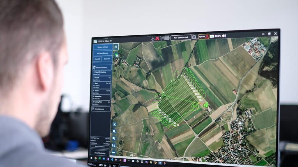
How to Plan a Drone Mission: (Part 2) Key Stages of a Drone Mission
Planning and executing a drone mission involves several crucial steps to ensure success and compliance. Below, we outline the essential stages of a drone mission, from preparation to post-flight reporting. Drone Check: Preparation and Equipment Before anything else, ensure that you have all necessary equipment ready. This includes the drone, fully charged batteries, controllers, and any additional sensors or tools required for the mission. https://youtu.be/rzstbhpOAuI?si=bePxtLiYc_-m1J4L Weather Check Weather conditions play a significant role in the planning and execution of a drone flight. Check the forecast to anticipate wind, rain, or other weather conditions that could impact the flight path and safety. Mission Planning Carefully plan the drone’s flight path, considering the objectives and the area’s geography (and weather of course). This step is crucial for maximizing efficiency and gathering the needed data effectively. Permissions and Regulatory Compliance Verify that you have all required permissions and that your mission complies with local drone regulations. This includes ensuring that the flight area is not restricted and that you have the necessary approvals for commercial drone activities. Pre-Flight Checks Conduct thorough pre-flight checks to ensure the drone is in perfect working order. This includes checking the drone’s hardware, software, and communications systems to prevent any issues during the flight. Execution: Flying the Drone Execute the flight plan, controlling the drone within the established parameters and adjusting as needed based on real-time observations and conditions. Reserve and Contingency Planning Always have a backup plan, which may include having spare parts, extra batteries, or even a backup drone. This ensures you can complete the mission even if unexpected problems arise. Debrief and Reporting After the flight, conduct a debrief to review how the mission went and any issues encountered. Depending on the mission type, deliverables might include detailed reports, surveys, photographs, or 3D models. Ensure these are prepared and delivered according to the client or project requirements. Mission Complete! Each of these stages is designed to optimize the success and safety of your drone operations. By methodically preparing and following through each phase, you can ensure that your drone missions are effective, compliant, and safe. Whether you’re capturing stunning aerial photography or conducting critical infrastructure inspections, attention to these details will provide the best outcomes and enhance your operational capabilities. For further guidance or to discuss the specifics of your upcoming drone mission, don’t hesitate to reach out. Our team is ready to support you with expert advice and guidance on what drone to use for your mission. Related Blogs
What to Consider When Buying an Enterprise Drone in the UAE

Enterprise drones are becoming an essential tool across a wide range of industries. Whether it’s inspections, mapping, monitoring or data collection, their role in business operations is growing – and with that comes a need for clear, reliable guidance on how to choose the right one. If you’re thinking about bringing a drone into your workflow, this guide will help walk you through a few key points to keep in mind, especially when it comes to buying and operating drones here in the UAE. Identify The Correct Drone For Your Requirements Finding the right drone starts with understanding what your business really needs – and that’s not always straightforward. Some companies know exactly what they’re looking for, while others are still exploring their options. Either way, working with a knowledgeable reseller makes all the difference. Discussing the reason that you need a commercial drone and the results you are looking for, will help when getting advice on which drone to buy. Find a Drone Supplier You Can Rely On From comparing enterprise models to understanding technical requirements and capabilities, having the right support can help you make a more confident decision. That’s why it’s worth choosing a drone supplier who offers genuine aftercare and ongoing support – not just a transaction. We have a team of dedicated experts on hand to help guide your decision, ensuring the drone you choose is the right fit for your business both now and further down the line. Understanding Eligibility For Enterprise Drone Purchases In the UAE, enterprise drones are classified as regulated equipment, which means they can only be sold to registered companies with a valid trade license. This is to ensure the proper permissions are in place before any drone ownership is transferred or products shipped. The process typically involves obtaining a No Objection Certificate (NOC) from Dubai Civil Aviation, as well as approval from SIRA – the Security Industry Regulatory Agency. These approvals are necessary to authorise the sale. For companies based outside the UAE, SIRA also provides the export permit required for international delivery. Without these permissions, the sale cannot be completed legally. Important Steps To Be Aware Of Before an enterprise drone can be registered and used legally, there are a few important steps to be aware of – especially here in the UAE: -Letter of Confirmation (LOC): The company purchasing the drone will need to get an LOC from the Ministry of Industry and Advanced Technology (MOIAT). This document allows the drone to be registered under the company’s name. -Trade License & Aviation Registrations: If you intend to fly the drone within the UAE, it’s important to make sure your trade license includes the correct activities for operating drones. You’ll also need to be registered with both the Dubai Civil Aviation Authority (DCAA) and the General Civil Aviation Authority (GCAA) to apply for the permits required to fly legally. -Even if the drone is available and in stock, approvals can take a little time. SIRA (the Security Industry Regulatory Agency) usually takes around 7–10 working days to approve a sale within the UAE. For international orders, the timeline is typically 2–3 weeks, depending on the country and its regulations, however this can vary. You will need to factor in this time when making a purchase. (If you’re based outside the UAE, it’s best to check with your local civil aviation authority to understand what’s required in your region.) Understanding the steps involved in purchasing an enterprise drone – whether it’s choosing the right model, identifying a trusted reseller, or navigating local regulations – can make a big difference in how smooth the process is. While there are a few important requirements to keep in mind, the right guidance can make it much more manageable! If you support or have any questions along the way, we’re here to help you make informed decisions and move forward with confidence. Contact our friendly team today! Related Blogs
Mavic 3 Enterprise vs Matrice 4 Series
When it comes to choosing the best commercial drone for your needs, DJI offers two standout options: the Mavic 3 Enterprise and the new Matrice 4 series. Both drones excel in their respective fields, but they cater to different requirements. Let’s compare them and help you decide which is the right fit for your operations… A Closer Look… The Mavic 3 Enterprise Series stands out for its compact size and portability, making it perfect for quick take-offs and fast-paced work. Its lightweight design ensures easy transportation and supports an optional RTK module to enhance its detailed mapping and surveying tasks – making the Mavic 3E a well-rounded and user-friendly option for both beginners and seasoned pilots alike. In comparison, the Matrice 4 Series is built to tackle more challenging and intricate tasks. While it may not be quite as portable as the Mavic 3, it offers a diverse range of advanced features such as its integrated DJI RTK modules with GNSS and Vision Fusion Positioning to provide high accuracy, making it the ideal choice for more complex operations that require extra capabilities. Performance & Flight Time The Mavic 3 Enterprise offers an impressive 45-minute flight time, making it perfect for long operations. Its compact, foldable design ensures easy portability for professionals on the go. Featuring a 4/3 CMOS 20MP wide-angle camera with a mechanical shutter, it captures fast, blur-free shots for smooth and efficient mapping. Plus, the 12MP telephoto camera with up to 56× hybrid zoom lets you capture detailed images from a distance. The Matrice 4 series offers around 40 minutes of flight time and excels when it comes to carrying heavier, specialised payloads thanks to its robust build – making it perfect for demanding tasks like surveying and industrial inspections. With a 4/3-inch 20MP wide-angle and two 48MP telephoto cameras (1/1.5 inch & 1/1.3 inch), it’s been expertly built to handle complex surveys and detailed inspections with ease. *Keep in mind that the payloads for the Mavic 3 Enterprise Series & the Matrice 4 Series are not interchangeable. This is something to consider if you’re looking to use existing payloads across both drone models! Thermal Imaging For tasks that require thermal imaging, the Mavic 3T offers a 640 × 512-pixel thermal camera. It’s equipped with features like point and area temperature measurement, high-temperature alerts, and color palettes, making it an excellent choice for quickly assessing critical situations. The Matrice 4T on the other hand, takes thermal imaging to the next level. It combines a 48MP wide-angle camera, two telephoto cameras, a thermal camera, and a laser rangefinder, all working seamlessly to provide accurate, detailed data. This powerful setup is perfect for advanced thermal and night operations, providing the precision and depth you require for complex missions. Our Conclusion… When deciding between the Matrice 4 Series and the Mavic 3 Enterprise, it really comes down to what you’re looking for. If you’re handling more intricate tasks that require top-tier imaging, precision, and versatility, the Matrice 4 Series is your go-to. It’s packed with advanced features and built for those complex, high-end operations. On the flip side, if portability and ease of use are more your style, the Mavic 3 Enterprise strikes a perfect balance. It’s great for quick deployments and standard tasks like inspections, making it an excellent choice for those who need something reliable and efficient on the go. If you’re unsure which one fits your needs best, don’t worry, our team at Drone Shop is here to guide you! We offer expert advice to help you make the most of your commercial drone investment. Thanks for reading, and feel free to explore our related articles below if you want to dive deeper into drone insights! Related Blogs
How Drone Software Enhances Operational Efficiency
In this blog, we’ll look at the different types of software that make drones more useful. Whether it’s for drawing maps, planning flights, or analysing photos, these programs help get the most out of every flight. Mapping Software Facilitates the creation of detailed maps and 3D models from aerial images, crucial for sectors like agriculture, construction, and real estate. This software is fundamental in transforming high-resolution aerial images into detailed topographic maps and 3D models. It is invaluable in industries requiring precise geographical data, such as agriculture, construction, and urban planning. By streamlining data collection, mapping software reduces the need for extensive manual surveys, saving time and resources. Analytics Tools Processes data from drone flights to provide actionable insights, vital for optimizing operations in fields such as agriculture for crop health monitoring or infrastructure for progress tracking. Utilizing these tools, drone operators can harness complex data for practical applications, streamlining workflows and boosting the accuracy of outcomes. This level of analysis is indispensable for sectors that rely heavily on precise and timely data, from environmental monitoring to urban planning. Flight Planning Tools Enables precise route planning based on factors like terrain, weather, and regulatory restrictions, ensuring efficient and safe flights. Critical for operational planning, flight planning software ensures that drones operate within safe and legal parameters. It helps operators plan flights that maximize battery efficiency and coverage area while adhering to no-fly zones and weather conditions. This not only helps in avoiding potential hazards but also ensures compliance with aviation regulations. Most drones come with their own specific software, but there are third party software’s out there that can be used as well for different projects. 3D Modelling Tools Enhances the ability to create complex, detailed three-dimensional representations of captured data, ideal for industries requiring precision modelling like architecture and urban planning. 3D modelling software provides a deeper level of detail in visualizations, allowing professionals to create precise models of physical spaces. This capability is particularly useful in construction, architecture, and heritage preservation, where accurate 3D representations are essential for planning and documentation. Notable software brands in these categories include Bentley, Pix4D, and AgiSoft, which are well-recognized within the industry for their capabilities in processing and modelling complex data sets. Each type of software plays a pivotal role in maximizing the effectiveness and safety of drone operations. We hope you found this article useful, for personalized advice on integrating drone software into your operations, or for recommendations on the best tools for your specific needs, our experts are ready to assist. Contact us today to streamline your drone operations and enhance your operational capabilities. Related Blogs